Japan / Tohoku Region /
JP056Mounts Zao, Funagata
Site Description
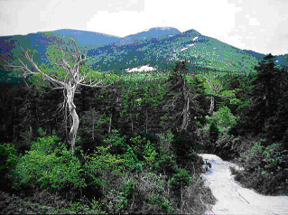
Forest
Volcanic mountain range, forests (secondary forest, broadleaf deciduous forest and conifer forest), and lapillus land, sandwiched by the Zaorenpo mountain range in the south and Funagatarenpo mountain range in the north, both belong to the Ohusanmyaku mountains on the border of Yamagata and Miyagi Prefectures. The highest summit of the Zaorenpo mountain range is Mt. Kumanodake (1,841m), which has forests of Fagus crenata and Quercus crispula on the mountainside, and forests of Abies mariesii on the higher area, as well as lapillus land. Funagatarenpo mountain range has forests of Fagus crenata and Quercus crispula on the mountainside, and Pinus pumila belt on the upper zone.
Area & Coordinates
52,000ha 38°18′N 140°32′E
region: Tohoku
Category
A3
Designation Type
Quasi-National Park, Prefectural National Park
Protection Status
Partially protected
Conservation issues
- Recreation/tourism
- Construction/impact of dyke/dam/barrage
- Deforestation (commercial)
Birds
Breeding resident
Buteo buteo, Spizaetus nipalensis, Aquila chrysaetos, Parus ater, Nucifraga caryocatactes
Breeding visitor
Pernis apivorus, Butastur indicus, Cuculus fugax, Halcyon coromanda, Apus pacificus, Anthus hodgsoni, Prunella rubida, Erithacus akahige, Emberiza sulphurata, Emberiza variabilis, Tarsiger cyanurus, Pyrrhula pyrrhula, Terpsiphone atrocaudata
Winter visitor
Phoenicurus auroreus, Turdus pallidus
Image
©OOSAWA Yasuo
![]()
