Japan / Kanto Region /
JP079Miyakejima island
Site Description
Coastline; Forest
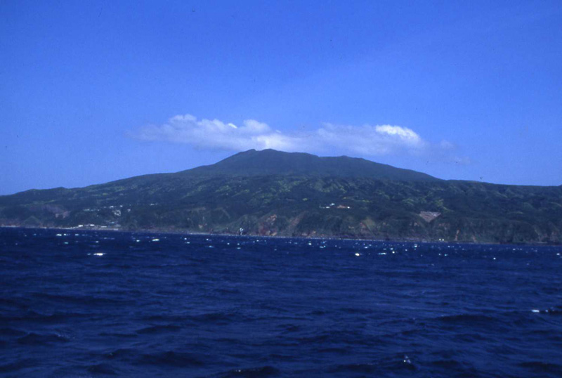
Miyakejima, which is located about 180 km south-southwest of Tokyo metropolitan area, is a volcanic island with the circumference of nearly 35 km and with an area of 55.5 km2. This island has experienced repeated volcanic eruptions, and some distinctive volcanic features like Tairo-ike pond and the former Shinmyo-ike pond can be seen everywhere on the island. From the shore to the area around 450 m above the sea level, we can see evergreen broadleaf forests which mainly consist of Castanopsis cuspdata , Machilus tunbergii and Camellia japonica, etc., as well as secondary forests which consist of some kinds of Alnus japonica and Prunus speciosa, etc.
Area & Coordinates
5,550ha 34°04′N 139°32′E
region: Kanto
Category
A1, A2, A4ii
Designation Type
National Park, Wildlife Protection Area (Local)
Protection Status
Protected
Conservation issues
- Disturbance to birds Construction/impact of dyke/dam/barrage
- Deforestation (commercial)
- Consequences of animal/plants/ introductions
Birds
Breeding resident
Columba janthica, Dendrocopos kizuki, Troglodytes troglodytes, Erithacus akahige, Turdus celaenops, Parus varius, Zosterops japonicus
Breeding visitor
Calonectris leucomelas, Cuculus poliocephalus, Apus pacificus, Locustella pleskei, Phylloscopus ijimae, Synthliboramphus wumizusume
Winter visitor
Phalacrocorax pelagicus, Buteo buteo, Falco peregrinus, Emberiza variabilis
Passage visitor
Puffinus tenuirostris, Sula leucogaster, Bubulcus ibis, Pluvialis fulva
Image
©YAMAMOTO Yutaka
![]()
