Japan / Kanto Region /
JP086Hahajima islands
Site Description
Forest
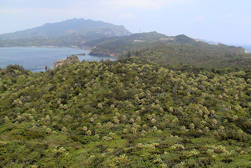
Hahajimaretto islands are located 1,050 km south of Tokyo metropolitan area. It consists of Hahajima, Mukojima, Hirashima, Anejima, Imotojima, Meijima and others. Hahajima, the largest island, is about 20.21 km, the highest point is Chibusayama at about 463 m high. The island has a perimeter of about 58 km, and most are steep cliffs. Although main islands had once been settled before the World War Ⅱ, all islands became uninhabited by the time of the reversion of Ogasawara islands to Japan in 1968. With this history, lost forests by the plantation have been rather recovered. However, Bischofia javanica, which was planted for firewood before the war is an invasive species competing with native vegetation since 1980, so the AKAGI (Bischofia javanica) extermination project has been going on.
Area & Coordinates
2,650ha 26°39′N 142°09′E
region: Kanto
Category
A1, A2
Designation Type
National Park, Wildlife Protection Area (government), World Heritage Candidate
Protection Status
Protected
Conservation issues
- Aquaculture/fisheries
- Recreation/tourism
- Consequences of animal/plants/ introductions
Birds
Breeding resident
Apalopteron familiare, Monticola solitarius, Cettia diphone, Columba janthica, Carduelis sinica
Breeding visitor
Sula leucogaster, Puffinus pacificus, Bulweria bulwerii, Anous stolidus, Diomedea nigripes, Oceanodroma tristrami, Pterodroma hypoleuca
Passage visitor
Pluvialis fulva, Arenaria interpres, Glareola maldivarum, Falco tinnunculus, Bubulcus ibis, Egretta intermedia, Upupa epops, Motacilla alba
Image
©Institute of Boninology
![]()
