Japan / Kanto Region /
JP088Kazan-retto islands
Site Description
Coastline; Forest; Grassland
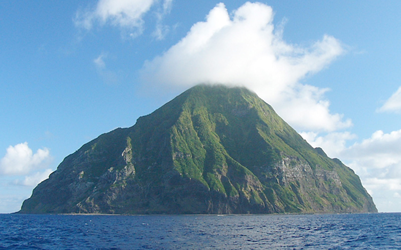
The islands in Iwohretto are still active. They are a chain of islands on the Pacific Ocean about 1,200 km south of Tokyo metropolitan area, consisting of three islands- Kitaiwohto, Iwohto and Minamiiwohto. Iwohto is a flat island and 23.16 km2, and the highest point is at about 169 m. While Minamiiwohto is 3.54 km2, of which the highest peak is at 918 m, and Kitaiwohto is 5.57 km2, of which the highest point is 792 m. The island has precipitous cliffs. Kitaiwohto was inhabited before the World War, but not after the War. Leucaena leucocephala forests mainly dominate. There are natural ponds and marshes on the north part of Iwohto island, which are seldom among Ogasawarashoto islands.
Area & Coordinates
3,255ha 24°47′N 141°19′E
region: Kanto
Category
A2, A4ii
Designation Type
National Park, Wilderness Area, National Monument
Protection Status
Protected
Conservation issues
- Aquaculture/fisheries
- Consequences of animal/plants/ introductions
Birds
Breeding resident
Monticola solitarius, Zosterops japonicus, Hypsipetes amaurotis, Cettia diphone, Columba janthica, Carduelis sinica, Phasianus colchicus, Bambusicola thoracica
Breeding visitor
Sula leucogaster, Puffinus pacificus, Anous stolidus, Anous minutus, Oceanodroma matsudairae, Pterodroma hypoleuca
Passage visitor
Pluvialis fulva, Arenaria interpres, Bubulcus ibis, Egretta garzetta, Ardea cinerea, Gallinula chloropus
Image
©Institute of Boninology
![]()
