Japan / Koshinetsu Region and Hokuriku Region /
JP101Katano-Kamoike
Site Description
Wetlands
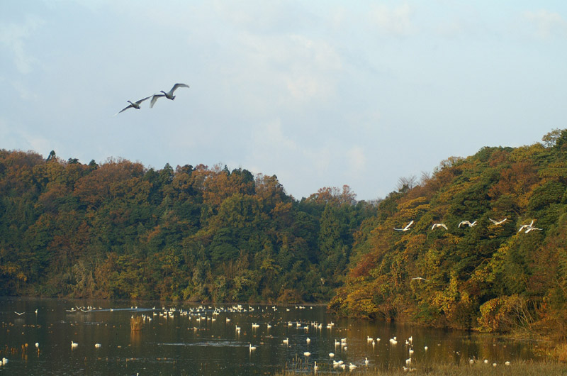
Katano-Kamoike was once a valley formed by fall of the sea level, the uplift of the land and erosion by running water. It was subsequently filled with water to form a pond. The area is covered with various aquatic plants. Around the pond there spread scrub forests such as Quercus crispula, broadleaf forests. Since the Edo Era, rice has been grown in paddy fields from spring to summer. Thanks to this fact the environment of wetlands has been preserved up to the present. But, due to the rice acreage reduction policy and the aging of farmers, rice cultivation is decreasing. As a result, Phragmites australis and other aquatic plants have grown thick and are gradually filling in the pond with their sediment (through the process of eutrophication).
Area & Coordinates
100ha 36°19′N 136°18′E
region: Kohshinetsu Hokuriku
Category
A1, A4i
Designation Type
Quasi-National Park, Wildlife Protection Area (government), National Monument, Ramsar Site
Protection Status
Protected
Conservation issues
- Agricultural intensification/expansion
- Natural events
- Consequences of animal/plants/ introductions
Birds
Breeding resident
Pandion haliaetus
Breeding visitor
Egretta intermedia, Pernis apivorus, Butastur indicus, Cuculus fugax, Cuculus canorus, Anas formosa, Haliaeetus albicilla, Accipiter gentilis, Circus spilonotus
Winter visitor
Botaurus stellaris, Anser albifrons, Anser fabalis, Cygnus columbianus, Anas platyrhynchos, Cuculus saturatus, Cuculus poliocephalus, Pericrocotus divaricatus, Turdus cardis, Ficedula narcissina
Passage visitor
Luscinia calliope, Emberiza sulphurata
Image
©Tajiri Hironobu
![]()
