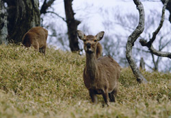
JP116Omine, Daiko mountains
Site Description
Forest
The site lies between Nara Prefecture and Mie Prefecture, mainly consisting of aqueous rocks created in the Palaeozoic and the Mesozoic Eras. The Omine Mountains have steep peaks and deep valleys. On the ridges of the mountains are subalpine forests of conifer trees and sheer rocky cliffs. The Daiko Mountains range from Ohdaigahara to Mt. Kunimi. Ohdaigahara is a non-volcanic elevated peneplain at about 1,500 m above sea level, and maintains vast primary forests of the Fagus crenata and Picae jezoensis var.hondonensis.
Area & Coordinates
40,000ha 34°11′N 136°07′E
region: Tokai Chubu Region
Category
A3
Designation Type
National Park, Quasi-National Park, Wildlife Protection Area (government), Wildlife Protection Area (Local)
Protection Status
Protected
Conservation issues
- Recreation/tourism
- Consequences of animal/plants/ introductions
- Natural events
- Consequences of animal/plants/ introductions
Birds
Buteo buteo, Sphenurus sieboldii, Cuculus fugax, Cuculus canorus, Cuculus saturatus, Dendrocopos leucotos, Anthus hodgsoni, Troglodytes troglodytes, Prunella rubida, Erithacus akahige, Tarsiger cyanurus, Turdus sibiricus sibiricus, Turdus chrysolaus, Cettia diphone, Phylloscopus borealis, Regulus regulus, Ficedula narcissina, Parus montanus, Parus ater, Sitta europaea
Image

©ICHIKAWA yuji
