Japan / Kyushu Region /
JP148Birojima islets
Site Description
Coastline; Forest
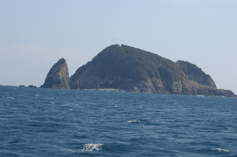
The site is an uninhabited islet with the circumference of about 1.5 km, which is located 7 km east offshore of Kadokawa-cho Miyazaki Prefecture. Kobirou is a subsidiary islet with the circumference of about 200 m, which is located in the north of Birojima islet. The islets are about 3 km away from the nearest land, and are washed by the Japan Current coming up the north. They have well-developed abrasion cliffs around them and have a lot of sheer cliffs in the form of columnar joints. The altitude of Birojima islet is about 75 m. The upper part of the islet is covered with evergreen broadleaf trees, such as Machilus tunbergii. However, the successive typhoons from 2003 to 2005 caused fallen trees and salt damage to tree trunks resulting in fallen leaves, which consequently opened up the forest making the forest floors sunny, and thus shrubs and undergrowth have flourished, showing a state of thickets. Besides, the thickets of shrubs growing on the forest edge, a large part of which also stands dead due to salt damage, look unhealthy.
Area & Coordinates
8ha 32°28′N 131°44′E
region: Kyushu Region, Miyazaki
Category
A1, A4ii
Designation Type
Quasi-National Park, National Monument, Wildlife Protection Area (Local)
Protection Status
Partially protected
Conservation issues
- Aquaculture/fisheries
- Recreation/tourism
- Consequences of animal/plants/ introductions
Birds
Breeding resident
Carduelis cinica, Monticola solitarius, Milvus migrans, Corvus corone, Corvus macrorhynchos, Egretta sacra
Breeding visitor
Synthliboramphus wumizusume, Columba janthina, Locustella pleskei, Bulweria bulwerii, Calonectris leucomelas, Apus pacificus
Winter visitor
Hypsipetes amaurotis, Turdus pallidus, Emberiza spodocephala, Phoenicurus auroreus
Passage visitor
Cyanoptila cyanomelana, Terpsiphone atrocaudata, Halcyon coromanda, Luscinia cyane
Image
©NAKAMURA Yutaka
![]()
