Japan / Shikoku Region /
JP128Lower Yoshinogawa river
Site Description
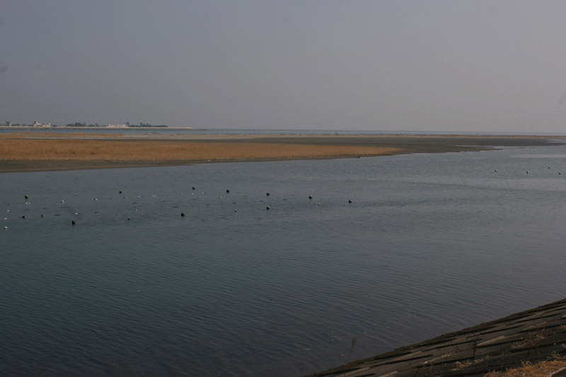
Wetlands
The Yoshinogawa river is the largest river in Shikoku, originating from Kamegamori (in Mt.Ishizuchisan system) with the total stream length of 193 km and width at the mouth of the river of 1.3km. The lower Yoshinogawa river belongs to Tokushima Prefecture. This site extends from the both sides of the river and from the estuary up to Nadabashi bridge. Surrounding the wide water area, there are sports grounds, farm fields, paddy fields and forests of Salix on the both sides of the river. There also exist sand bars, tidal flats and reed beds in the area. Sandy tidal flats which form islands in the river mouth area expand to a maximum of 60 ha at low tide. And around the reed beds along the river, mud flats of a sludge nature are formed. Among benthic creatures, crabs are most abundant in terms of the numbers of species and individuals. Many large shorebirds come to the site to feed on abundant crabs.
Area & Coordinates
3,800ha 34°05′N 134°35′E
region: Shikoku Region, Tokushima
Category
A4i
Designation Type
Wildlife Protection Area (Local)
Protection Status
Partially protected
Conservation issues
- Aquaculture/fisheries
- Infrastructure
- Construction/impact of dyke/dam/barrage
Birds
Breeding resident
Pandion haliaetus
Breeding visitor
Acrocephalus arundinaceus
Winter visitor
Anas penelope, Anas acuta, Podiceps cristatus, Calidris alpina, Crocethia alba, Larus saundersi, Aythya fuligula
Passage visitor
Charadrius mongolus, Charadrius leschenaultii, Pluvialis fulva, Calidris acuminata, Limicola falcinellus, Calidris ferruginea, Calidris tenuirostris, Arenaria interpres, Tringa nebularia, Heteroscelus brevipes, Numenius madagascariensis
Image
©MIYAKE Takeshi
![]()
